Tuesday, January 23, 2007

Candle Mill Village Falls


This is a great waterfall right on the side of the road on the way to Kelly Stand Road in East Arlington. So make sure you stop here and get plenty of pictures. This is just a little one that is further up from the roaring one that everyone sees.

Map to Candle Mill Village Falls

Kelly Stand Falls


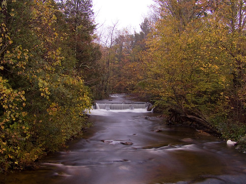
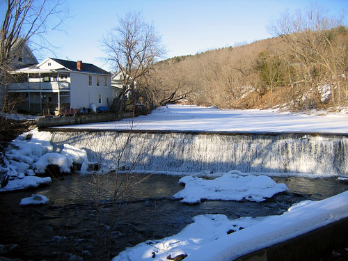
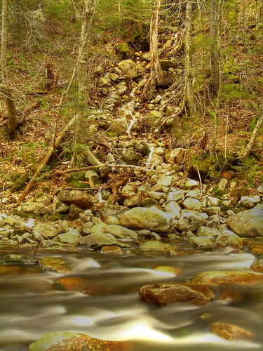
Now there are several waterfalls on Kelly Stand road in Arlington. I only name my waterfalls for the road they are on unless I know different. I know that this waterfall doesn't look like much in this photograph, but like all waterfalls if you catch it at the right time, say after a good rain, on when the snow is melting off the mountain I think you'll have a beauty. I took this one in the fall, we didn't have much rain this year.
Anyway once your on Kelly Stand Road it isn't too far along maybe about a mile or two, and it is on the left hand side of the road just before you go around a corner. As I recall it was over at least one bridge. So if you keep your eyes open you'll see it.
This is a great day trip I have been on this road a few times but never followed it all the way and when I did it was great! tons of photo taking opportunities there. Bring the family and make a day of it I say.
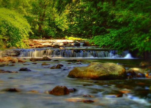
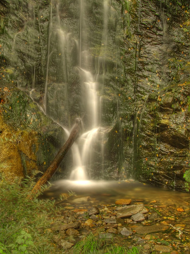
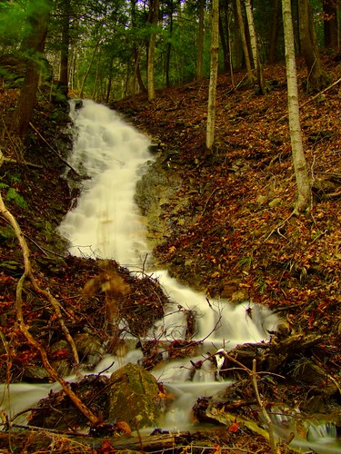
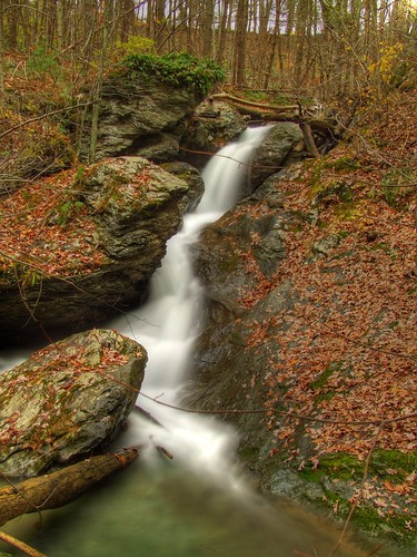
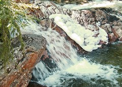
Here are a few more cascading waterfall pictures on the same road. Most are before you get to this one.
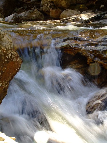
Here are a few more I took..


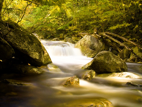
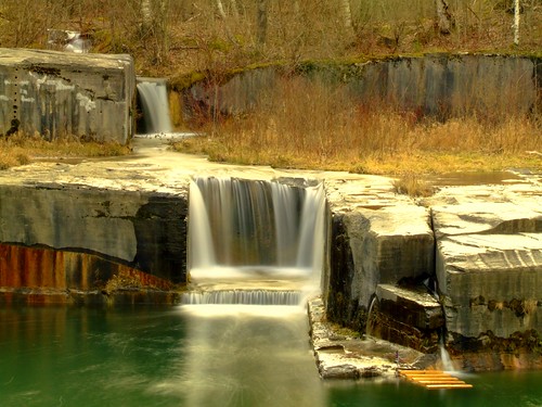
I have more pictures but I'll let you discover some of the waterfalls on this road for yourself.

By the way there is a waterfall off of this road called Lye Brook Falls, There is even a sign to it on the left. It's a pretty big waterfall from what I have seen in pictures, about 60' or so I believe. I haven't taken any myself yet, for a few reasons, one I haven't been there yet, and two it is a bit of a hike in from my understanding. I'll get some more info on it and post it as soon as I can.

Map to Kelly Stand Falls

Friday, January 19, 2007

Dummerston Waterfall


This was such a nice find, now I know I am putting a link to the map on here, but keep in mind it isn't perfect. I know it was definitely on Rout 30 about 2 miles north on the right hand side, tucked in a bit. So use the map as a guide line and just keep your eyes open, and on the road too! This waterfall is about 35' to 40' high, and it is a beauty. The only problem will be parking really it is on the side of the road and there isn't a place to pull off so just be careful and park off the side as far as you can so you don't get hit by any cars, it's a very busy road. You can get a nice shot from the road, there is plenty of room for your tripod and all, I suggest holding or waiting the tripod down, when Semi's go by it will move your gear and that can be a pain.
Good Luck!
Map to Dummerston Waterfall

South Stream Road Waterfall


This is a great waterfall, my first actually. As you can see there is a marked difference in everything about them. I didn't even realize it was the same one until I went back and looked at the map. The one taken in the winter was my first in so many ways, it was my first HDR (high dynamic range)and my first motion picture. Which as you can see I didn't have a clue what I was doing. But take a look at the same waterfall taken in the fall. It's not an HDR (Check my sister Website The Waterfall Hunter for more on HDR and how easy and fun it is.) but it is a wonderful waterfall photograph for other reasons. I am making it a plan to revisit each of the waterfalls in each season if possible to try and catch the true essence of each one. They all have there special time and some are in the winter and some are in the fall and well some are year round!

Just a note, this waterfall is on the same road, and stream that Snow Falls is on.
Map to South Stream Falls

Thursday, January 18, 2007

Dorset Quarry Swimming and Waterfall


Well folks you really can't miss this one, it is right off other side of the road on Route 30. If your heading north it is on the left and there is ample parking if your there in the off season. I took this picture in this January so not much swimming or anything else for that matter. The falls are a beautiful green and the water is very still in the pond. There are tons of big marble blocks to sit on and enjoy yourself in the warm weather. I hope to go back in the summer for some great action photographs.

Map to the falls

North Branch Falls


This picture was taken from the foot bridge that spans the North Branch just north of downtown Montpelier. Now I haven't been to this one so I don't know to much about it but I will follow up with Terrapin and find out if it is on private land and how hard it is to get to. This photo was taken from a public walk bridge in Montpelier. Easy to get to, and definitely public access.


Map to Waterfall


Submitted by a member of our Flickr Group Waterfalls of Vermont
Terrapin
Who has his own blog Terrapin Gardens

Monday, January 15, 2007

Snow Falls


This is just a beautiful waterfall. You can barely see it from the road so slow down and drive carefully as the road is a narrow dirt road, but well traveled. Please keep in mind this waterfall looks to only be reached in one of two ways either walking up stream about 1/2 mile to reach it or right next to it is a cabin. Please remember not to trespass, I have never met the people who own the cabin and have left a note asking for permission to go onto there land to get to it. But have heard from them
You can see it from the road once you get out, the evergreens are very thick, so it is somewhat of a hidden treasure. I reached by scaling down the side of the hill careful not to trespass.
Then stood in the water and got my shots. Make sure if you are there to take a picture you bring what you need with you. It will make things much easier.

If the people are home I would ask first just to make sure. Besides they might say yes.

Map to Snow Falls

Dorset Waterfall


This is one of those waterfalls that sneeks up on you. Unless your driving north with your head out of your window you will miss it all together. So go slow if your going north on Rout 7, it's on the left facing the north.
Obviously if your going south and you keep an eye on the right side you should have no problem seeing it.
I on the other hand have been on this road so many times I can't count and have only just found it the other day! :)

But there it is a god 60' of rushing water. Beautiful and amazing are the two words I would use to describe it!

Dorset Falls Map

Hemlock Falls


This is Hemlock falls is beautiful as you can see I would say this is about 50' high. It sits of the left hand side of a dead end road. The land is not marked private or no trespassing, but if you go all the way down the road you will find yourself at someones home. So please take care and mind other people property, and by all means take out what you bring in.

You can see this waterfall from the road just roll your window down and listen, the waterfall is maybe 50 yards through the woods.
Map to Hemlock Falls